Automatic Translation

Sunday, September 30, 2018

Hadrian's Wall Path Day 6: Heddon-on-the-Wall - Newcastle-upon-Tyne (19 km)


After breakfasting in the company of another walker and the proprietor of Houghton North Farm hostel, Jennifer and I set off at a good pace towards Newcastle - but before we had got very far, we were waylaid by villagers in Heddon-on-the-Wall. First we stopped to look at the longest section of broad Wall (i.e. ten-foot rather than eight-foot Wall) still standing. Before we had been there a minute, a very friendly lady with a small terrier came along and struck up a conversation. She started out talking about her dog, and then about the horses in the adjacent field, but when she got onto the topic of the Royal Family, we knew we were going to have a hard time escaping; luckily a group of cyclists arrived at the site, distracting the terrier and therefore its mistress. We beat a hasty retreat, but shortly thereafter made the mistake of entering the village church, St. Andrew's. It being Sunday morning, a service was about to start, and when we told the attendant at the door we just wanted to take a peek at the church before proceeding on our way along the Wall, he embarked on a personal tour of the church, which he defined as "just a quick look round before the service" but which went into considerably more detail than we had bargained for. However, a crisis arose when a desperate parishioner called to his attention the fact that the priest had failed to arrive for the service, and once again we were able to make an escape, at the price of paying 20 p for a brochure explaining the details of the church architecture and stained glass windows that the attendant hadn't had time to illustrate to us himself. 

A long stretch of broad Wall - with friendly lady & terrier approaching!
Once we finally managed to leave behind the extremely friendly inhabitants of Heddon-on-the-Wall, we were able to proceed towards Newcastle at a reasonably rapid pace, there being little else to distract us along the way. It was a pleasant walk along the north bank of the Tyne, past a golf course, cricket grounds and a rowing club, through parkland on the site of former coal mines, past a fragrant baked goods factory and on into an increasingly urban landscape. At Newcastle Central Station I said goodbye to Jennifer, off to rejoin her family for the working week, and checked into my hostel, where I recovered a small bag of things I had sent ahead care of Hadrian's Haul, did some grocery shopping and bought a waist pouch at the five-pound shop to replace the one with a broken zipper that I had thrown away! 

Golf course/Cricket club

Rowing club

The Tyne

Monument to the collier, with children and pony

The bridges of Newcastle come closer

Grainger Street - on the way to the hostel!

Heddon-on-the-Wall - Newcastle upon Tyne 19 km


Saturday, September 29, 2018

Hadrian's Wall Path Day 5: Wall - Heddon-on-the-Wall (25.5 km)

After a delicious dinner and a restful night at Hadrian's Hotel, we resumed our walk eastwards from Wall. Despite the abundance of wall-related place names, the Wall itself appears only occasionally above ground in this part of Northumberland. In many places it is underground, even under the highway, and so for much of the day our path followed the course of the modern-day road.

One bit of Wall we did see is at the spot where, due to budget cuts, the thickness of the wall was reduced from 10 to 8 feet.


The black sheep in the family!

Towards noon the wind came up and blew us across the fields and right into the Vallum Farm Tea Room, billed as "The foodie gateway to the wall", where we enjoyed an excellent lunch of rarebit followed by sticky toffee pudding with custard! 


Another ten kilometres and we reached our destination, the hostel at Houghton North Farm, where we dined on instant soup, cheese scones and apples... plenty of apples!


Wall - Heddon-on-the-Wall 25.5 km

Hadrian's Wall Path 4: The Sill - Wall (23.5 km)

A clear morning, with a touch of frost on the grass! I climbed back up the crags at Steel Rigg, past milecastle 39 and into Sycamore Gap, among the most iconic spots on the Wall.


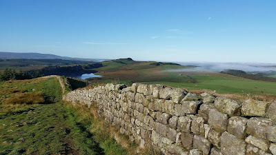
From the top of the succeeding crag I could look back at Peel Crag and Crag Lough and forward along a beautiful stretch of good solid Wall snaking up and down the slopes.


Sometimes, to avoid going up to the top of every single crag, I followed the route if the ancient Roman Military Way behind it.


At milecastle 37, part of the arch over the north gate has survived. I stopped here to enjoy the sunshine.


There followed a short section through the woods where the path is actually on top of the Wall.


At Housesteads Roman Fort I visited the museum and the ruins, and met up with my life-long friend Jennifer, who has come to walk with me for the weekend! We proceeded together along a beautiful stretch of Wall as the Crags gradually levelled off, stopping for lunch at the temple of Mithras in the unexcavated fort of Brocolitia.


From here the presence of the Wall became less continuous. 


After one more stop to visit Chesters Roman Fort - taking advantage of my investment in a nine-day Overseas Visitor Pass for all English Heritage Sites - we soon came to our final destination for the day, the appropriately named Hadrian's Hotel in Wall, where a pint of Sycamore Gap Pale Ale, a delicious dinner and a soft bed awaited us


The Sill - Wall 23.5 km


Thursday, September 27, 2018

Hadrian's Wall Path Day 3: Banks - The Sill (25+ km)

From Bowness-on-Solway on the west coast as far east as the fort known to the Romans as Banna, but now known under the name Birdoswald, Hadrian's Wall was a turf wall, with stone used only to build the turrets, due to a local shortage of limestone for mortar. This means very little of the Wall has survived. But from Birdoswald - only a few kilometres from Banks, where I spent the night at Quarryside B&B - eastwards, the Wall is made of stone and much more of it is still visible.


It is punctuated at regular intervals by turrets, two per Roman mile (1.48 km), plus signal towers and forts. 


I walked along the Wall to Birdoswald with two ladies from London who had been staying at the same bed & breakfast. They had no high-tech hiking gear, only leggings and running shoes, and their backpacks were too small so they carried the excess in shopping bags... it would have driven me crazy to walk like that, but my new companions seemed perfectly happy to go trooping over the moors looking for all the world as if they were out on a Saturday shopping trip! 


Birdoswald Fort


On either side of Birdoswald is a still-standing section of wall running about a kilometre and a half long, making this the longest continuous section of wall still in place.


Not long after Birdoswald Fort the trail drops down into the valley to cross the Irthing River via the Millennium Bridge, currently undergoing repair (which made for some excitement, crossing the river on the wooden planks the workmen have laid to fill in for the mussing bit). Further east, where the river flowed in Roman times, the abutments of a Roman bridge, rebuilt three times between AD 122 and 207, may still be seen.


At Gilsland, I left Cumbria behind and entered Northumberland - where my trip began almost a month ago!


Coming out of the village, the path lies in the Vallum, the defensive ditch dug behind the Wall, which is at present underground here, with a "modern" dry stone wall built on top of it and the mound formed by the rubble from digging the ditch visible on the other side.


This led to Thirlwall Castle, the name of which means "hole in the wall" castle. The hole was probably made, or at least made bigger, when the castle was built - out of recycled stone from the Roman Wall!
It was by now getting quite blustery, so I joined two ladies taking shelter from the wind within the castle walls for a picnic lunch.


Lunch at the castle

More fields, more sheep and cows, and then the path came to Walltown Quarry, now a national park, and the landscape changed dramatically as the Whin Sill came into view! 


This is the start of the toughest part of the trail, the Crags. The path rises and falls, rises and falls, over a succession of rocky outcrops. I tackled a series of these under an increasingly gloomy sky.


I passed among cattle grazing in the Roman fort of Aesica.


It grew misty and wet, and I began to wish I were out of the Crags and safely in my room at the hostel, when suddenly the clouds lifted and the sun came out over the Crags! My spirits lifted and I enjoyed covering the last few kilometres up and down to the hostel at The Sill with spectacular views!


Winshields Crag - the highest point on the trail


Banks - The Sill 25 km + (patchy GPS signal)