Jetzt sind wir in einer Situation, in der wieder zusammenwächst, was zusammengehört.
("Now we are in a situation where what belongs together, will grow back together.")
- Willy Brandt, Berlin radio interview on November 10, 1989 (the day after the abolition of intra-German border controls)
 |
| Via Romea marker on the rubble of the former border wall |
My day began with 10 kilometres walking out of Meiningen along a paved cycling track. But my feet didn't mind the asphalt so much after a good night's rest! After passing through the pretty village of Sülzfeld, I realised that my gps track of the entire Via Romea Germanica route in Germany differed from the signage on the ground, and from the official track of this individual stage on Outdooractive. I decided to follow the latter, as it was probably more up to date, and it looked like it would take me to some interesting places!


The route eventually left the cycling track to follow a dirt track through a forest, where there were signs identifying various tree species and a wooden "sofa" beside a fenced-in area with tame deer. The deer were very curious and approached the fence, taking a closer look at me, and I at them. I'm not sure whether the fence was to protect the deer, or to protect the plants in the rest of the forest from the deer; within the fenced-in area, the grass was very short, and there was no undergrowth left at all!
I came out of the forest and onto a paved road leading to the Deutsch-Deutsche Grenze, the former Inner German Border. Time to cross from Thüringen into Bayern, or Bavaria - and back onto the western side of the former border!
As when I crossed into the former DDR almost two weeks ago, as described in my May 3 blog entry, it was an emotional experience. Today, I approached the former border along a road made for East German tanks, leading up to a hilltop observation tower.


Escape with the sweeper
On May 24, 1989, 62-year-old Helmut Wenzel, a professional driver from Meiningen, had the task of sweeping the road from Meiningen to the border with his sweeper. Before entering the border section, he was given the usual instructions by Major Huck, the officer on duty at the border crossing point. In the section between the observation tower and the border, the driver was personally supervised by the major. At around 8:40 a.m., Wenzel swept the right side of the road in the direction of Eußenhausen; instead of turning around at the border, he accelerated, ignoring the stop sign and the major's calls. He did not stop until he reached the western control building, informed the border police officer of his escape, and was immediately directed behind the office building out of the major's range and sight. Helmut Wenzel stated that the reason for his escape was that his wife did not want to return to the GDR after a three-week visit to North Rhine-Westphalia. The People's Police had known about the wife's visit, but did not consider Wenzel's work directly on the border risky, because he had already been doing this work for years.


 |
| By an old boundary stone, probably predating the wall |


 |
| "We said goodbye to our children, without knowing if we would ever see them again. 9 October 1989, Leipzig" |


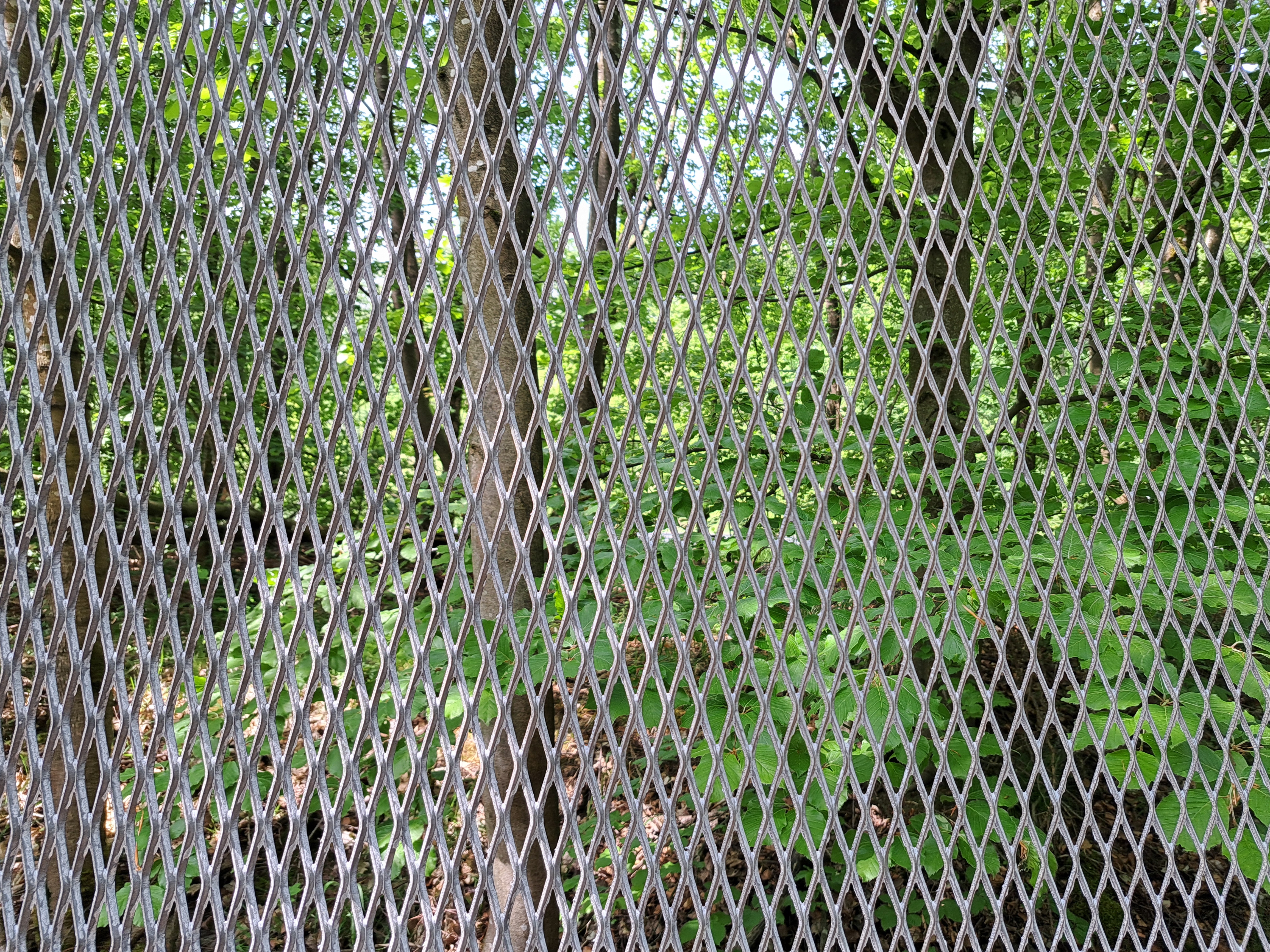 |
| The border fence was made of expanded sheet metal, which is impossible to climb |

The US Army had been present on the Inner German Border since 1945: they drove along the border with patrols in jeeps or armored reconnaissance vehicles. In the 1970s they limited their observation to individual observation bases. These initially consisted of earth bunkers, later of solid houses on the Abtsberg near Brüchs, between Sondheim and RoBrieth and the Kehrspitze near the Schanz. There the entire hilltop was fenced in with barbed wire. Even border officials from the Federal Republic were only allowed to enter the area with a special pass from the MIC (US Army Military Intelligence). The post was manned day and night by four soldiers from Camp Lee, near Wollbach. They were also equipped with night vision devices, which often triggered false alarms. The post once reported a large number of refugees, which then turned out to be a herd of deer!
The bunker was easy to see from the GDR side. The GDR border guards had special rules of conduct near the bunker. They had to be as covert as possible. Open conversations were forbidden because there were suspected listening devices in the base. Experts from the border police consider this unlikely, because most US soldiers were too poor at speaking German to make it worthwhile! The post's observations were passed on to the MI office on Martin Luther Street in Bad Neustadt. From there, the information was passed on to the border police inspection in Mellrichstadt. After the fall of the Berlin Wall, the observation point was dismantled.
Exiting the Grenzemuseum, I took a wrong turn and had to walk back... uphill... as my phone battery got lower and lower! I finally found the right path, the entrance to which was hidden by a fallen tree. Then I hurried along a dirt track downhill through the woods, missing another turning because I was trying to use my phone as little as possible. The road I was on looked like it would take me to the same place, but then it became littered with fallen trees and broken branches; rather than turn back, uphill, I scrambled down the bank to the road where I was supposed to be. From there it was only a short walk into Eußenhausen, and to Pension Euring, where I arrived with 10% battery charge to spare!


A poignant reminder of the divisions that still beset us. But hopefully the reunification of Germany and the broadening of the European Union show us the way forward.
ReplyDeleteAnother extremely interesting post, thank you.
ReplyDeleteThe MyTrails app looks very interesting. I went hunting for it and found that it's not available through the Android Play Store.
No, I think it's a legacy app that's not available any more. But you can use any app that handles gps tracks, I like to set the map in the background to satellite view
Delete